File:Frog-point-map.jpg
From The Infomercantile
Jump to navigationJump to search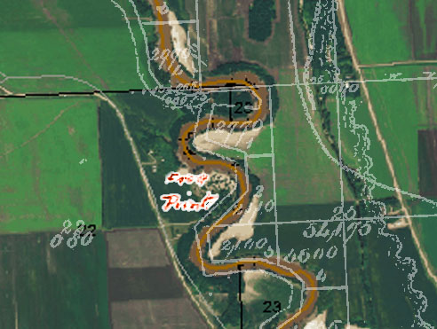
No higher resolution available.
Frog-point-map.jpg (492 × 371 pixels, file size: 62 KB, MIME type: image/jpeg)
Composite of the original Minnesota plat maps and current North Dakota GIS information. The Minnesota plat has, in faint pencil, written "Frog Point" in the margin. The Minnesota survey was done in 1875; Not long after, Frog Point's name was changed to Belmont.
File history
Click on a date/time to view the file as it appeared at that time.
| Date/Time | Thumbnail | Dimensions | User | Comment | |
|---|---|---|---|---|---|
| current | 15:03, 1 January 2011 | | 492 × 371 (62 KB) | AzraelBrown (talk | contribs) | Composite of the original Minnesota plat maps and current North Dakota GIS information. The Minnesota plat has, in faint pencil, written "Frog Point" in the margin. The Minnesota survey was done in 1875; Not long after, Frog Point's name was changed to |
You cannot overwrite this file.
File usage
The following page uses this file: