File:Railroad Map of the US, 1955.jpg
From The Infomercantile
Jump to navigationJump to search
Size of this preview: 767 × 600 pixels. Other resolutions: 307 × 240 pixels | 3,984 × 3,114 pixels.
Original file (3,984 × 3,114 pixels, file size: 1.62 MB, MIME type: image/jpeg)
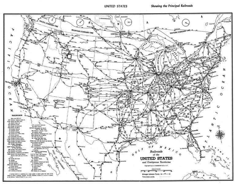
1955 map of the US railroad system, taken from "Hammond's Pictoral Travel Atlas of Scenic America". As you'll see in the list below, it's a Short Line away from having all the Monopoly railroads represented (Pennsylvania, B&O, and Reading all appear on the map).
Railroads Represented on Map
This is a copy of the 'key' to railroad names on the map:
- ATSF Atchison, Topeka, and Santa Fe
- ACL Atlantic Coast Line
- A&WP Atlanta and West Point
- B&O Baltimore and Ohio
- B&A Bangor and Aroostook
- B&M Boston and Maine
- CN Canadian National
- CP Canadian Pacific
- CG Central of Georgia
- CNJ Central R.R. of New Jersey
- CV Central Vermont
- C&O Chesapeake and Ohio / Pere Marquette
- C&EI Chicago and Eastern Illinois
- C&NW Chicago and North Western
- CB&Q Chicago, Burlington, and Quincy
- CGW Chicago Great Western
- CI&L Chicago, Indianapolis and Louisville (Monon)
- CMSPP Chicago, Milwaukee, St Paul, and Pacific
- CRIP Chicago, Rock Island, and Pacific
- D&H' Delaware and Hudson
- DL&W Delaware, Lackawanna, and Western
- DRGW Denver and Rio Grande Western / Denver & Salt Lake
- E Erie
- FEC Florida East Coast
- Ga. Georgia
- GT Grand Trunk
- GN Great Northern
- GM&O Gulf, Mobile, and Ohio / Alton
- IC Illinois Central
- KCS Kansas City Southern
- LV Lehigh Valley
- L&A Louisiana and Arkansas
- L&N Louisville and Nashville
- MC Maine Central
- MSPSSM Minneapolis, St Paul, and Sault Ste Marie (Soo)
- MKT Missouri - Kansas - Texas
- MP Missouri Pacific
- NCSL Nashville, Chattanooga, and St Louis
- NRM National Rys. of Mexico
- NYC New York Central
- Nkl. Nickel Plate (New York, Chicago, and St Louis)
- NYNHH New York, New Haven, and Hartford
- N&W Nortfolk and Western
- NP Northern Pacific
- Pa. Pennsylvania
- PRSL Pennsylvania - Reading Seashore Lines
- R Reading
- RFP Richmond, Fredricksburg, and Potomac
- SL-SF St Louis - San Francisco
- SLSW St Louis Southwest
- Sbd. Seaboard
- SP Southern Pacific
- Sou. Southern
- SP&S Spokane, Portland, and Seattle
- TC Tennessee Central
- T&P Texas & Pacific
- UP Union Pacific
- W Wabash
- WP Western Pacific
- WRA Western Ry. of Alabama
File history
Click on a date/time to view the file as it appeared at that time.
| Date/Time | Thumbnail | Dimensions | User | Comment | |
|---|---|---|---|---|---|
| current | 20:44, 26 May 2007 | | 3,984 × 3,114 (1.62 MB) | AzraelBrown (talk | contribs) | 1955 map of the US railroad system, taken from "Hammond's Pictoral Travel Atlas of Scenic America". Category:Maps |
You cannot overwrite this file.
File usage
There are no pages that use this file.