File:The-Canadian-Lakehead-Land-Of-The-Sleeping-Giant.jpg
From The Infomercantile
Jump to navigationJump to search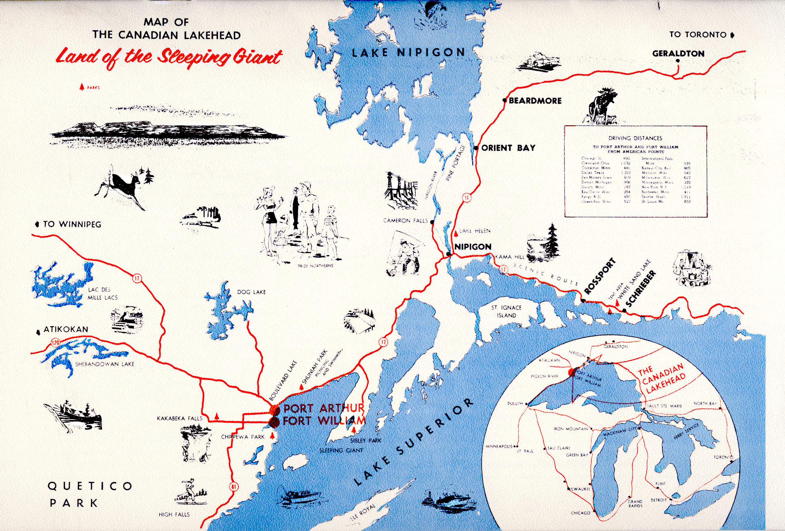
Size of this preview: 800 × 541 pixels. Other resolutions: 320 × 217 pixels | 2,598 × 1,758 pixels.
Original file (2,598 × 1,758 pixels, file size: 1.24 MB, MIME type: image/jpeg)
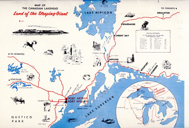
Captioned "The Canadian Lakehead -- Land of the Sleeping Giant", this map cover the area around Fort William, Port Arthur, Lake Nipigon, and the northern edge of Lake Superior in Ontario, Canada. It was published in a brochure form the Fort William chamber of commerce in the 1960s.
File history
Click on a date/time to view the file as it appeared at that time.
| Date/Time | Thumbnail | Dimensions | User | Comment | |
|---|---|---|---|---|---|
| current | 01:16, 27 January 2008 | | 2,598 × 1,758 (1.24 MB) | AzraelBrown (talk | contribs) | Captioned "The Canadian Lakehead -- Land of the Sleeping Giant", this map cover the area around Fort William, Port Arthur, Lake Nipigon, and the northern edge of Lake Superior in Ontario, Canada. It was published in a brochure form the Fort William chamb |
You cannot overwrite this file.
File usage
There are no pages that use this file.