File:Illustrated-Map-Of-Fort-William-Ontario-Canada-1960s.jpg
From The Infomercantile
Revision as of 01:12, 27 January 2008 by AzraelBrown (talk | contribs) (This illustrated map of Fort William, Ontario, Canada was published in a Chamber of Commerce brochure in the 1960s. Category:Maps)
Size of this preview: 774 × 599 pixels. Other resolutions: 310 × 240 pixels | 2,175 × 1,684 pixels.
Original file (2,175 × 1,684 pixels, file size: 977 KB, MIME type: image/jpeg)
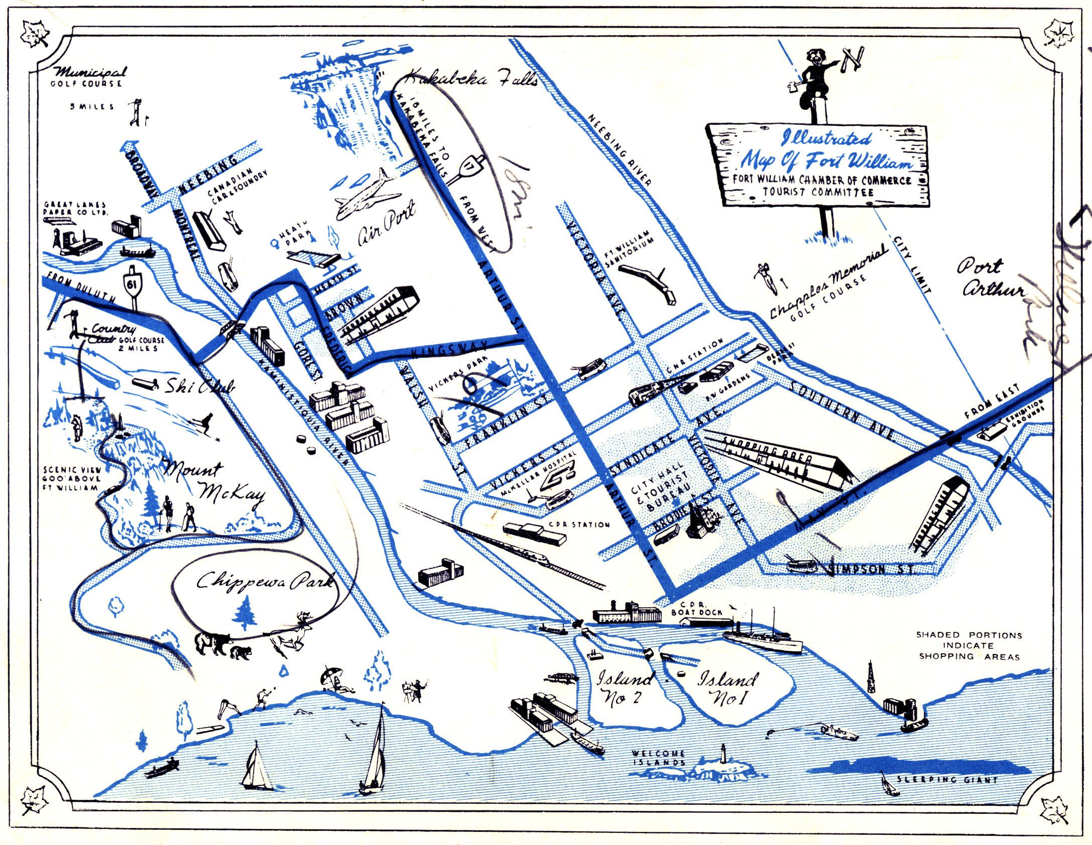
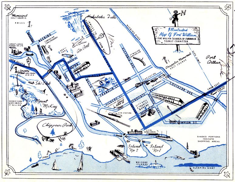
This illustrated map of Fort William, Ontario, Canada was published in a Chamber of Commerce brochure in the 1960s.
File history
Click on a date/time to view the file as it appeared at that time.
| Date/Time | Thumbnail | Dimensions | User | Comment | |
|---|---|---|---|---|---|
| current | 01:12, 27 January 2008 | | 2,175 × 1,684 (977 KB) | AzraelBrown (talk | contribs) | This illustrated map of Fort William, Ontario, Canada was published in a Chamber of Commerce brochure in the 1960s. Category:Maps |
You cannot overwrite this file.
File usage
There are no pages that use this file.