Categories
Uncategorized

Flooded Doghouse, 1950.

Click for full image


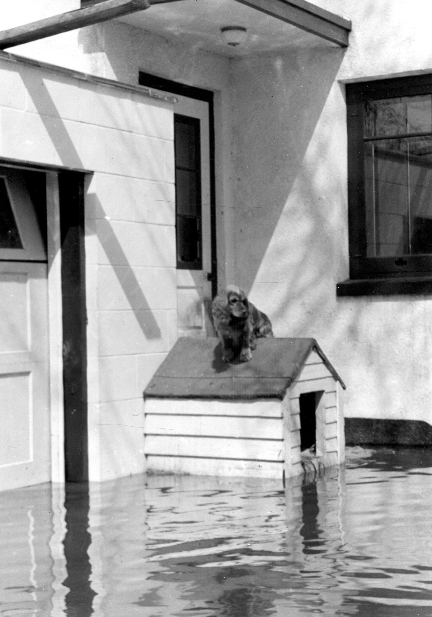
The 2009 Flood has crested in Grand Forks and the river is falling, but in 1950 even the dogs were victims. In this posed photo, an unhappy cocker spaniel surveys the swollen Red River of the North from the peak of his home, just outside a flooded Grand Forks house (the address, 317 Euclid Ave, no longer exists). From this group of photos.

Categories
Uncategorized

Red River Flood, 1952.


Click for full image

Mrs. Colin Campbell would not be ousted from her home: she is standing on the roof of her back porch, after climbing out a second story window. The water is about 4 feet away from covering her feet, but she was non-plussed; in the accompanying article, she defied police attempts to evacuate her, declaring it was a good time to catch up on her embroidery. On April 16, 1952, the Red River crested at around 35 feet; a USGS paper declared it the highest crest since 1897. Her address, 106 1st Avenue South, no longer exists; Urban Renewal wisely razed the neighborhood south of Main and east of 4th street, which was regularly subject to inundation even in light flood years.

Categories
Uncategorized

Red River Flood, 1969.

Click for full image


In April, 1969, the Red River of the North overflowed its banks, reaching 37.3 feet on the 15th, and expected to crest at 38 feet a few days later. This aerial photo appeared on the front page of the Fargo Forum on the 15th, showing the dike’s position in relation to saving city hall, the Civic Center, and the year-old library. Today, the dike runs down 2nd street, atop the river bank, but in 1969, they let the swollen river cover the big parking lot, and ran the dike along 3rd street, just outside City Hall’s front doors; the Town House hotel, at the far right in the big picture, looks on the verge of flooding, but safe enough.

Categories
Uncategorized

Red River Flood, 1897.


Click for full image
Today, Fargo-Moorhead is readying itself for an unbelievable 40ft+ crest of the Red River on Friday, and are preparing, around the clock, by filling sandbags and building dikes. Twelve years ago we had another huge flood which filled some neighborhoods with water, a hundred year flood so to speak. In fact, a hundred years before that hundred-year flood was the 1897 flood, seen above: floods of this type weren’t completely unusual — urban renewal cleared out the most flood-prone neighborhoods during the 1970s on both sides of the river, which had been routinely inundated whenever the river got high. The area of Moorhead in the photo above, however, is still on high ground and is residential: the building on the left seems to still exist, while the one on the right does not. The USGS believes the 1897 flood hit the 40-foot mark as well.