Click for full image
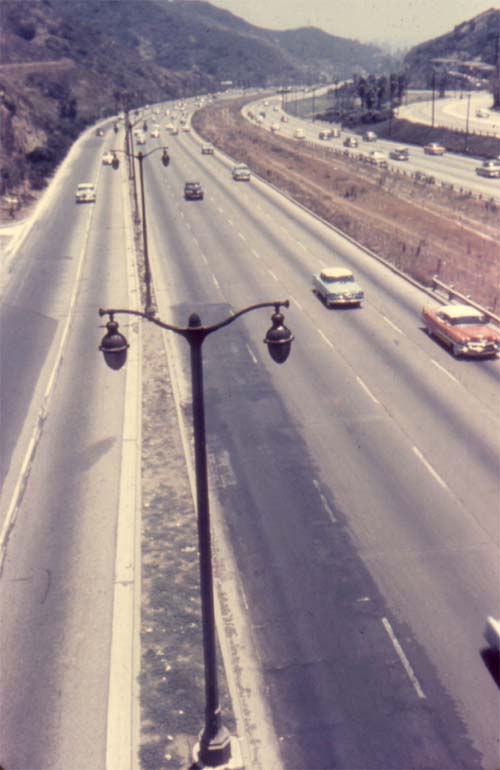
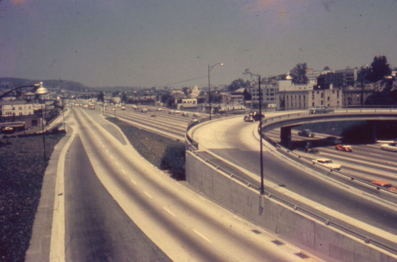
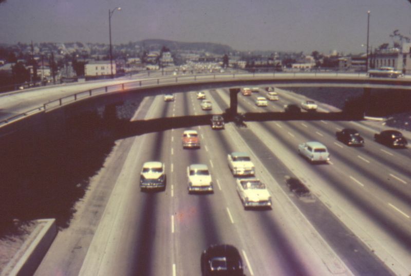
The Hollywood Highway, from a collectible set of slides honoring the Los Angeles Freeway System, vintage 1950s or 1960s.

The Hollywood Highway, from a collectible set of slides honoring the Los Angeles Freeway System, vintage 1950s or 1960s.
San Francisco still has Gray Line offering bus tours of their beautiful city, all these years later. The map above is from 1953, from a pamphlet called “Really See San Francisco.” I’m just including the map here, but the rest may follow someday. Nearly 60 years ago, here’s what the attractions via a bus tour were:
All you had to do was dial Yukon 6-4000, and you could hit the road in style! I’m impressed that Del Monte was such a large part of the various tours — post WWII, it had mostly been taken over by the Navy School, although all the land around the hotel was full of gardens, woods, and golf courses, still accessible to tourists at the time. “Chinatown after dark” is an interesting name: while the tour, given the clientèle of city bus tourists, was probably quiet and unoffensive for the time, I wonder if it was tied-in to the movie of the same name from 1931.
As for the map itself: I’m a fan of purposeful maps, ones that don’t spare the information about what it feels relevant, but ignores the irrelevant whenever possible. This isometric view includes landmarks and gives a nice sensation of distance, which then also lets riders know how much time will be spent looking out the window at non-landmarks.
The wrinkles from the glue are disappointing, because this is such an excellent photo-montage of activities available at the Hotel del Monte in Monterey, California. Horses, it seems, were the key activity, whether they pulled carriages, were rode by fair women, or were raced against each other on a track. From the Hittel’s Hand-book of the Pacific Coast in 1882:
The most interesting feature of the town of Monterey, for the tourist, is the Hotel del Monte, erected by the capitalists of the Southern Pacific Railroad Company for the accommodation of visitors. It is one of the most complete buildings on the continent for the accommodation of pleasure-seekers. The length is 385 feet, the width, 115; the height, 3 stories. There are accommodations for 400 guests. The hotel has its own gas works, and is supplied with water from its own artesian well. The grounds of the hotel have an area of 100 acres, partly in beautiful garden and lawn, and the remainder wooded with oak, pine, and cypress trees. Neat by, and under the same ownership, are 7,000 acres of land, through which there are fine roads, open to the patrons of the hotel. A bathing pavilion contains four tanks, each 50 feet long and 36 wide. These are fulled with salt water which is heated to a temperature of about 70°. There are also separate bathrooms. The whole establishment is managed in the best style, and it has done much to attract great numbers of visitors to Monterey. The hotel is within a few yards of the beach, so that those who prefer to bathe in the ocean need not tire themselves by walking to reach it.
The building seen above, however, was a reconstruction of the original Del Monte, which burned to the ground in 1887. The investors of the Southern Pacific Railroad spared little expense to develop the finest resort hotel in California, away from the larger cities, bordering both the forest and the ocean. The hotel expanded with new amenities like those seen above over time, and eventually passed into the ownership of Samuel F.B. Morse. Morse, already owner of Pebble Beach Golf Course, now also controlled the Del Monte golf course, the oldest golf course in the West. This also put Morse in the position of rebuilding the hotel yet again when the building pictured above burned in 1924.
Could you stay at the Hotel del Monte today? You can’t exactly go as a visitor, but you can walk the halls SFB Morse built if you were a Navy officer. In 1943, the wartime flight training school leased the hotel and turning it into an educational home; the Naval Postgraduate School was moved there in 1951, occupying all 627 remaining acres of former tourist grandeur.

Well, here we’ve got an entirely different view of the Harbor Freeway (compared to a few weeks ago). California’s pride in their municipal freeways was immense: in theory, they provided an escape from the crowded streets of other metropolitan areas, and allowed for relaxing suburban living while working in the city. Today, we see this as Sprawl, a bad thing, but in the sixties it was The Way Of The Future.
see also: history of future la * 1970s concept la proposal * interior of lax * more 60s freeway (1) (2)
 I know I’ve been picking on North Dakota for its scenic vastness, but is this so much better? Back in the 1960s, California was so proud of its freeway system that — like Arizona with its Grand Canyon, South Dakota with its Mount Rushmore, New York with its Niagara Falls — they released a set of collectible slides documenting the Los Angeles Freeway System. MARVEL at the expanses of concrete and pavement! SMELL the pollution wafting up from the vehicles! CRINGE IN TERROR at how close those two cars are in the third lane from the left! Oh, I kid — unlike where I live, you can actually see some hills off towards the horizon. Between here and there, however, is a concrete jungle. I still prefer here.
see also: pre-freeway map * California highways * more photos * just newer cars today * house stranded on CA highway