|

| |
|
|  |
Dakota City, 1859.
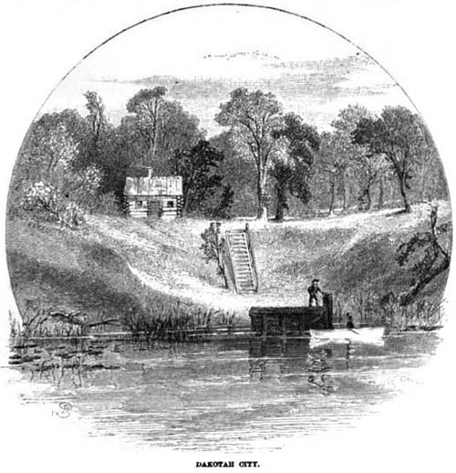
Click for full image In the 1850s, as what would become the Dakota Territory grew in population and industry, townsites were claimed in hopes of profiting on the westward expansion. Dakota City was one: at the confluence of the Sheyenne and Red Rivers, opposite Lafayette, Minnesota, it hoped to grow and flourish. Today, it no longer exists. The location of Lafayette (which also no longer exists) is well documented, but the original location of Dakota City is still inconclusive. Image above from an 1860 edition of Harper's magazine, documenting a pre-Territory trip along the eastern border of Minnesota, a freshly-minted state at the time. Labels: 1850s, north dakota history
Dakota City, North Dakota, 1890s.
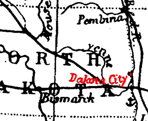
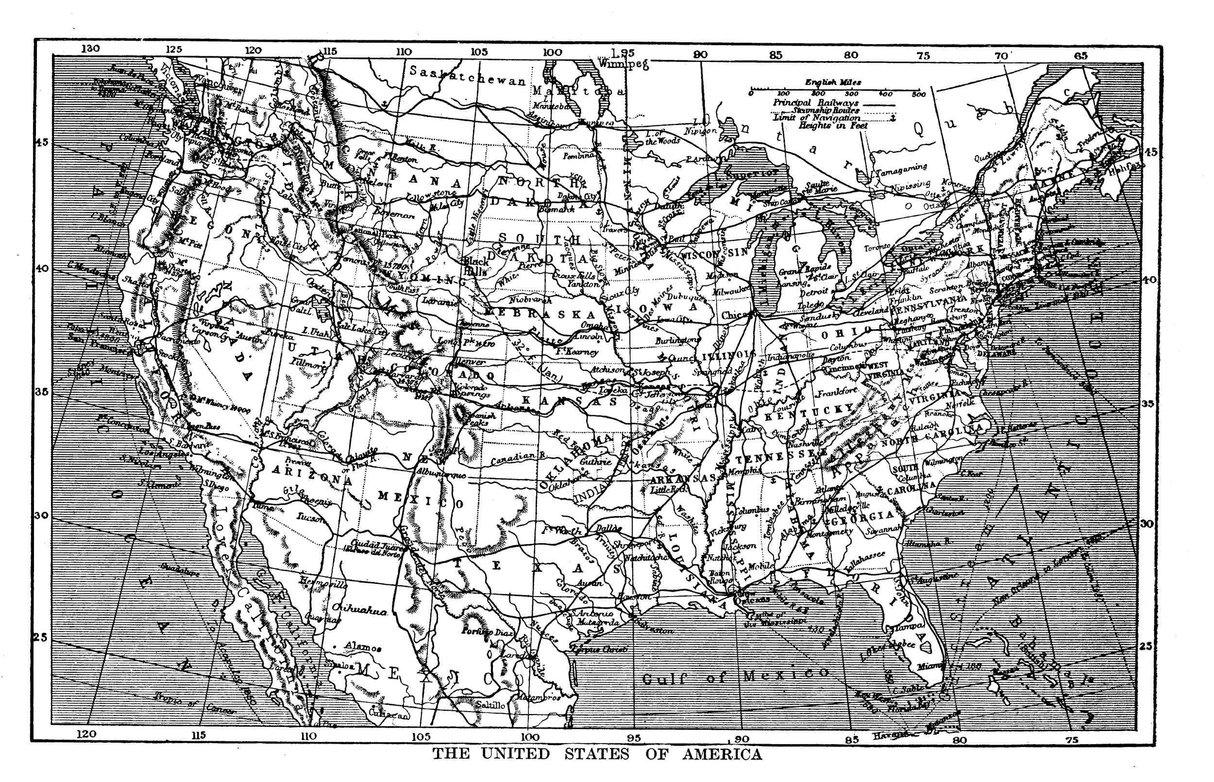
Click for full imageGreetings from scenic Dakota City, North Dakota! It took a little research to figure out what the cartographer was going off of, but the issue may be the result of lazy mapmaking. The full-sized map comes from the Harmsworth Self-Educator, a British encyclopedia from the 1910s. On closer examination, it's odd to see a river called the "Yenne" running curling around the eastern half of the state — that is actually the "She yenne River", which had at some point lost the first part of its name. The mapmaker who produced the map during the 1890s was copying off a map about 40 years older. "Dakota City" was a small settlement, just north of the Sheyenne/Red River confluence about ten miles north of Fargo, north of Harwood's current townsite, established in the 1850s. According to Origins of North Dakota Place Names by Mary Ann Barnes Williams, "In 1895, one log cabin stood at the crossing of the Red River, just opposite LaFayette, Minn., on the Dakota side...known as Dakota City." That one lone log cabin was occupied in the 1860s by "Monsieur Marchaud, a French Canadian, his Chippewa wife and twelve children," according to Seat of the Empire by Charles Coffin. Dakota City, its neighbor Lafayette, and numerous other small townsites never succeeded in reaching actual town status, disappearing well before this map was published. Labels: 1890s, dakota city, maps, north dakota history
Climate Map of North America, N.D.-Centric, 1929.
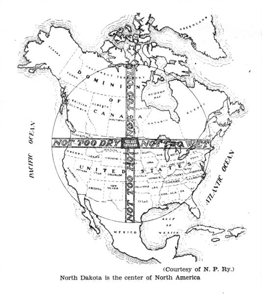 Saying " North Dakota is the center of North America" is a factual truth; just outside Rugby N.D. is a monument to that fact. What's more remarkable is the interpretive turn: the map paints North Dakota as the baby bear's porridge of our continent. West is Too Dry, north is Too Cold, east is Too Wet, and south is Too Hot. North Dakota meets in the middle, and is thus the perfect place to live, right? I'm a fan of the state, you know, but we're actually in a position that gets all of the above: deadly droughts, destructive floods, sub-zero winters and 100°+ summers. It seems the cartographer who drew the map was mistaking us for Hawaii. I know, it's an easy mistake to make, but it's an over-simplification of what North Dakota's climate is like. Labels: 1929, maps, north dakota history
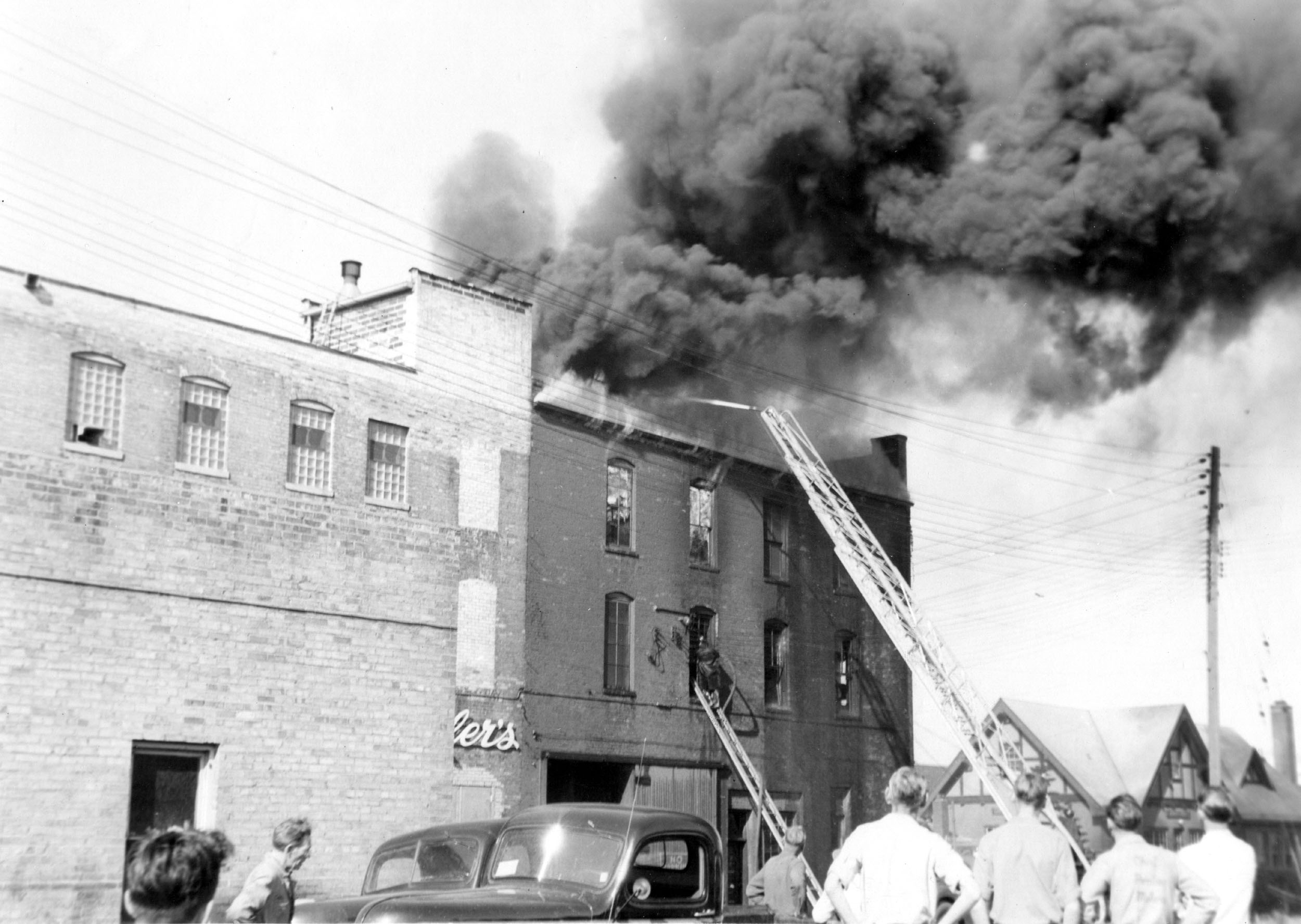
Sinner For Congress, 1964.
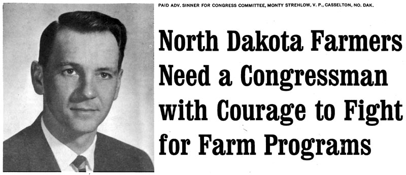 In 1964, a fresh state senator from Casselton, ND, made an attempt to move up the ladder and join Senator Quentin Burdick in Washington D.C.. Unfortunately, State Senator George Sinner was beat out by Republican Mark Andrews. Sinner's attempt at Congress was barely a speed-bump in his career: after working with a variety of local and regional governments and organizations, he became Governor of North Dakota from 1985 to 1992. Labels: george sinner, north dakota history, politics
| |
|
|