 |

| |
|
|  |
Antarctica, 1890s.
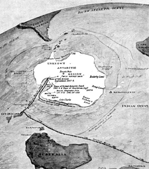
Click for full image It is usually left off of world maps, but in this one Antarctica is the guest of honor. Most flat map projections, even if they do include Antarctica portray it as a wide band of white, with little visualization of how it actually appears. Above is a map viewing the spherical Earth from a southerly position, providing the least distortion to Antarctica, but giving a very different view of where South America, South Africa, New Zealand, and Australia lie in relation. The map's purpose is to show various expeditions to locate the South Pole; the map was reduced such that the labels are almost unreadable even in the original. From the multivolume The Book of History, 1890s. Labels: 1890s, antarctica, exploration, maps
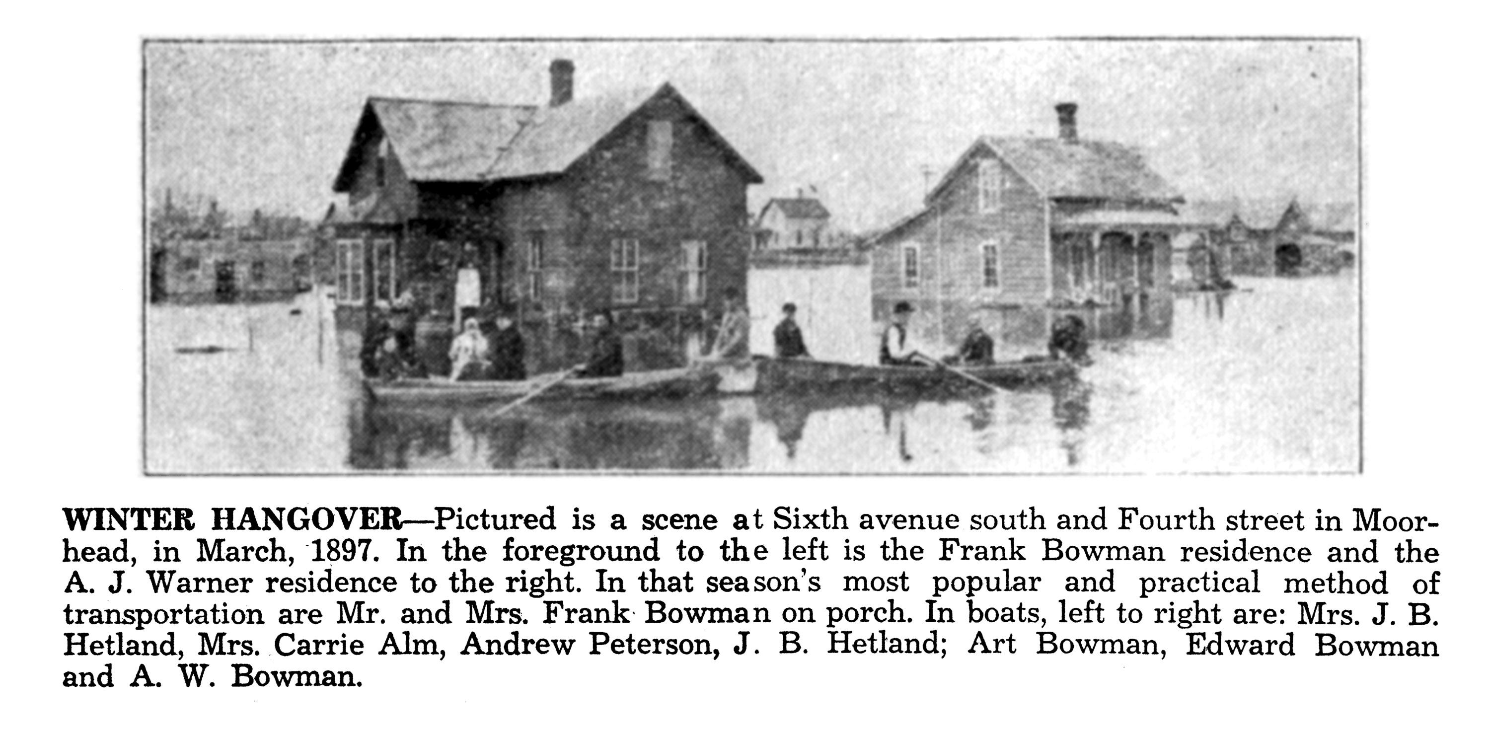
Red River Flood, 1897.
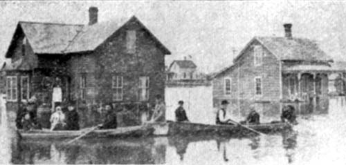
Click for full imageToday, Fargo-Moorhead is readying itself for an unbelievable 40ft+ crest of the Red River on Friday, and are preparing, around the clock, by filling sandbags and building dikes. Twelve years ago we had another huge flood which filled some neighborhoods with water, a hundred year flood so to speak. In fact, a hundred years before that hundred-year flood was the 1897 flood, seen above: floods of this type weren't completely unusual — urban renewal cleared out the most flood-prone neighborhoods during the 1970s on both sides of the river, which had been routinely inundated whenever the river got high. The area of Moorhead in the photo above, however, is still on high ground and is residential: the building on the left seems to still exist, while the one on the right does not. The USGS believes the 1897 flood hit the 40-foot mark as well. Labels: 1890s, 1897, fargophilia, flood, red river
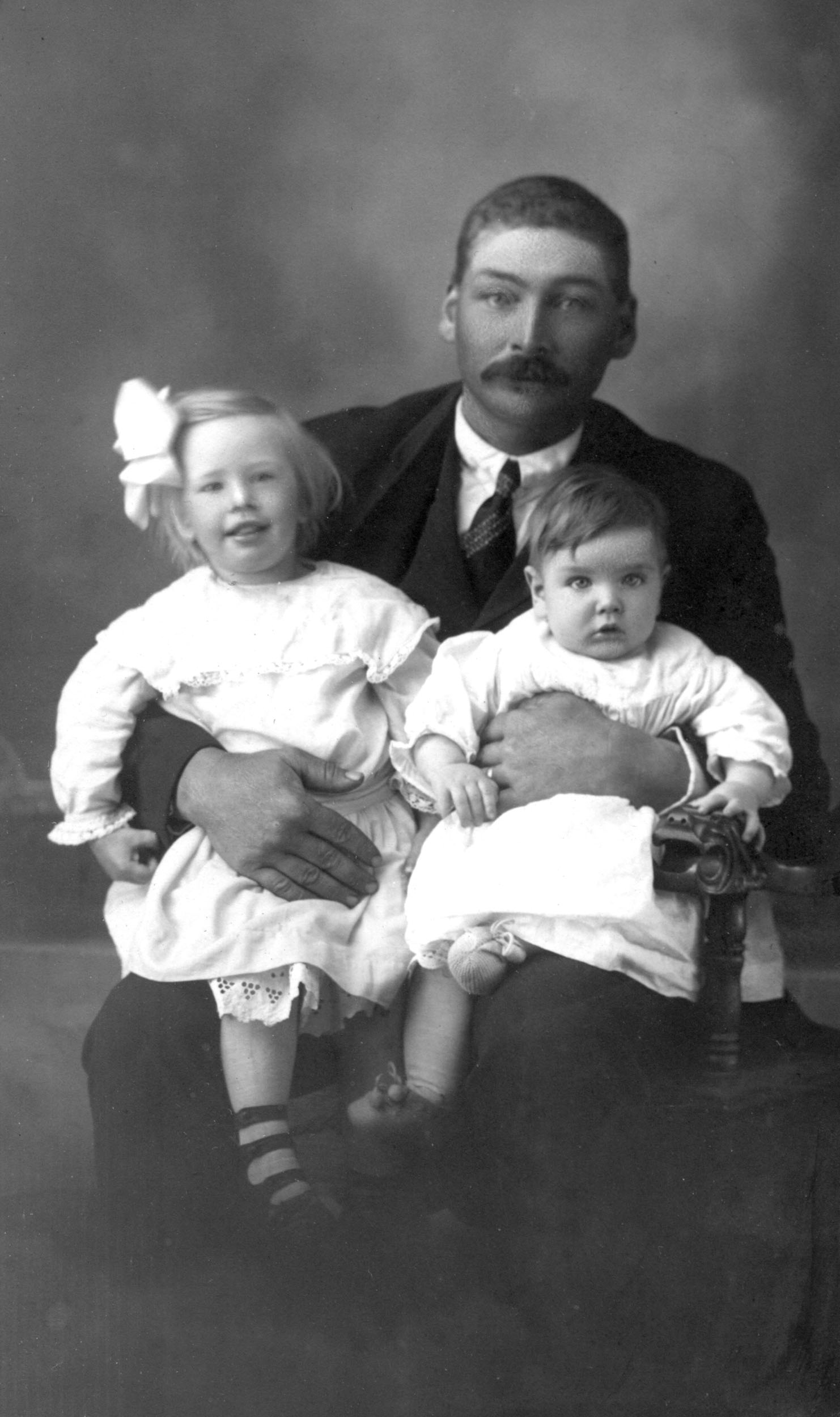
Father and Daughters, 1890s.
Dakota City, North Dakota, 1890s.
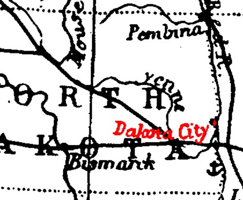
Click for full imageGreetings from scenic Dakota City, North Dakota! It took a little research to figure out what the cartographer was going off of, but the issue may be the result of lazy mapmaking. The full-sized map comes from the Harmsworth Self-Educator, a British encyclopedia from the 1910s. On closer examination, it's odd to see a river called the "Yenne" running curling around the eastern half of the state — that is actually the "She yenne River", which had at some point lost the first part of its name. The mapmaker who produced the map during the 1890s was copying off a map about 40 years older. "Dakota City" was a small settlement, just north of the Sheyenne/Red River confluence about ten miles north of Fargo, north of Harwood's current townsite, established in the 1850s. According to Origins of North Dakota Place Names by Mary Ann Barnes Williams, "In 1895, one log cabin stood at the crossing of the Red River, just opposite LaFayette, Minn., on the Dakota side...known as Dakota City." That one lone log cabin was occupied in the 1860s by "Monsieur Marchaud, a French Canadian, his Chippewa wife and twelve children," according to Seat of the Empire by Charles Coffin. Dakota City, its neighbor Lafayette, and numerous other small townsites never succeeded in reaching actual town status, disappearing well before this map was published. Labels: 1890s, dakota city, maps, north dakota history
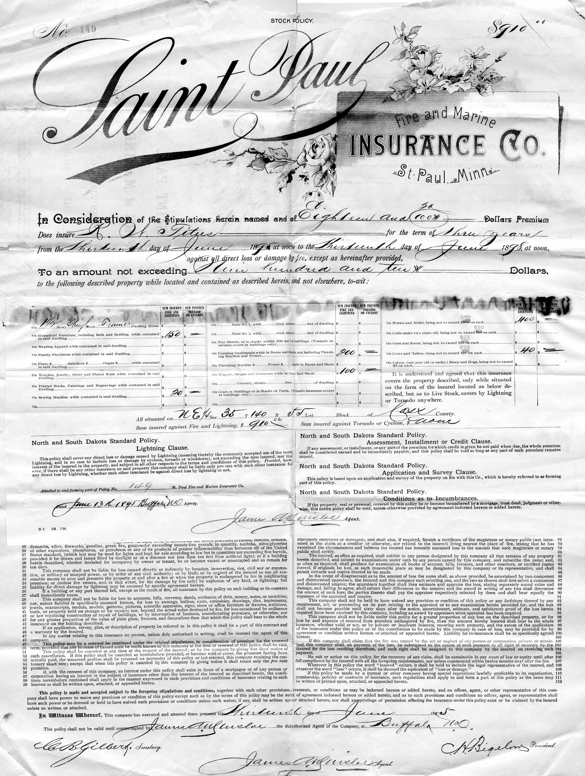
Farm Insurance, 1895.
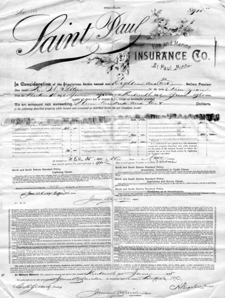 A hundred and thirteen years ago, R.U. Titus stood in his farmyard and looked upwards, wondering what sort of terror might plunge out of it -- lightning, tornadoes -- and decided he should buy some insurance on him home, horses, and farm equipment. Today, whoever still lives at the farmstead on the NorthEast quarter of Township 140, Range 55, Section 35 looks up and wonders just how much resolution those terrain sattelites can get:
View Larger MapLabels: 1890s, farming, insurance
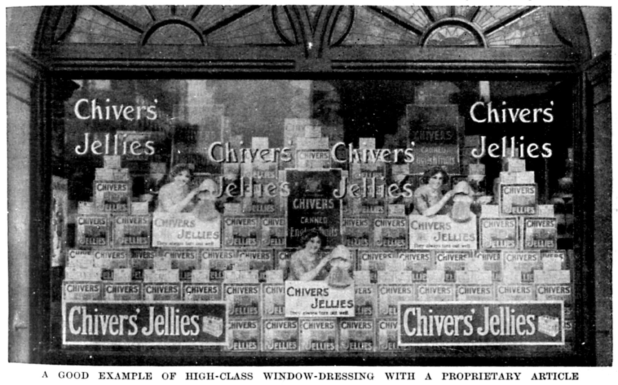
Chivers' Jellies Window Display, 1890s
 The caption reads, A good example of high-class window dressing with a proprietary article. That proprietary article is Chivers' Jelly, preserves from a UK company that still happens to be around — albeit now part of an international conglomeration and located in Ireland. Labels: 1890s, advertisement, chivers' jellies, england
Confirmation Class, 1890s.
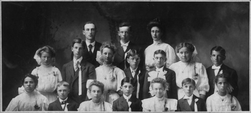 Unmarked cabinet photo of unusual proportions. Appears to be a confirmation class from the late 19th century, but I was unable to find any explanation for the white, candle-like ribbons on the men. Labels: 1890s, cabinet photo, confirmation, religious photo
Black Dress, Wooden Screen, 1890s
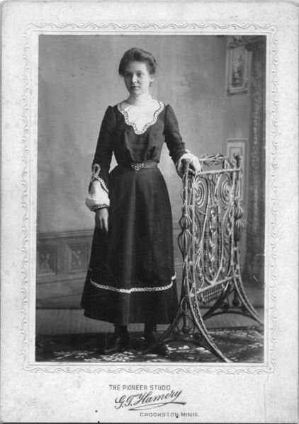 A cabinet card portrait of a woman wearing a plan black dress, standing with one hand on an intricately woven bent-wood fireplace screen. The view behind her is a hand-painted backdrop depicting the interior of a house. Portrait by G.T. Hamery of Crookston, Minnesota, late 19th century. Labels: 1890s, cabinet photo, painted backdrop, woman
Look At Old Chicago
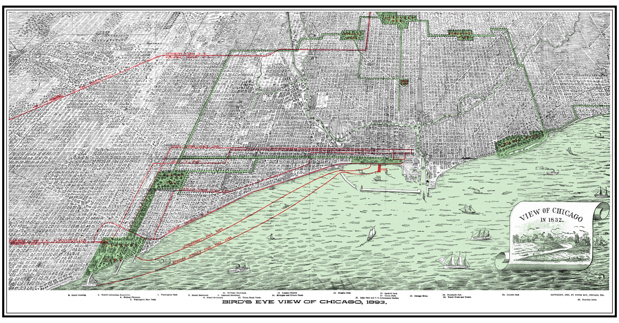 Think you know Chicago? This map will probably interest you. Live in old Chicago? You can probably see your house from here. Distributed for the 1893 World's Exhibition, on this side it shows an entire map of Chicago -- which, in pre-automobile-times, was probably as difficult to cross as it is to travel across entire states today. Without Google Maps, AAA, or even a casual knowledge of the city beyond a half-mile, people needed to know how to get from their home to the Expo: a city-wide map was necessary. The back has pictures of various features in the Expo -- I may get around to scanning it eventually. Labels: 1890s, 1893, chicago, maps, world's exhibition
| |
|
|


