 |

| |
|
|  |
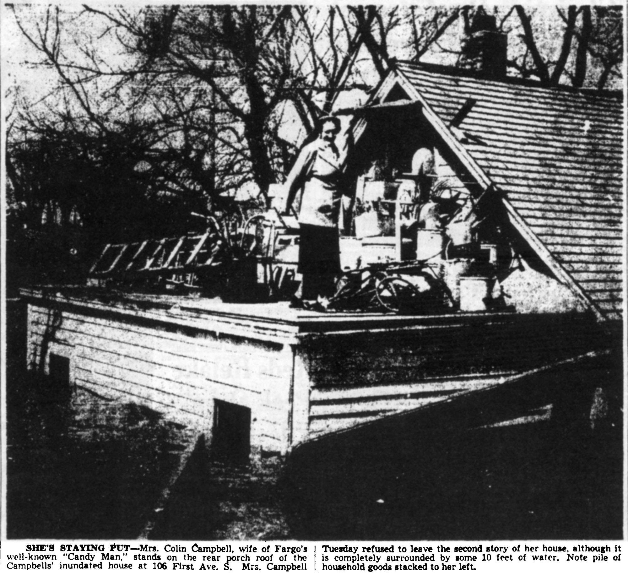
Red River Flood, 1952.
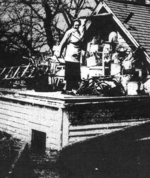
Click for full imageMrs. Colin Campbell would not be ousted from her home: she is standing on the roof of her back porch, after climbing out a second story window. The water is about 4 feet away from covering her feet, but she was non-plussed; in the accompanying article, she defied police attempts to evacuate her, declaring it was a good time to catch up on her embroidery. On April 16, 1952, the Red River crested at around 35 feet; a USGS paper declared it the highest crest since 1897. Her address, 106 1st Avenue South, no longer exists; Urban Renewal wisely razed the neighborhood south of Main and east of 4th street, which was regularly subject to inundation even in light flood years. Labels: 1950s, 1952, fargo, fargophilia, flood, red river
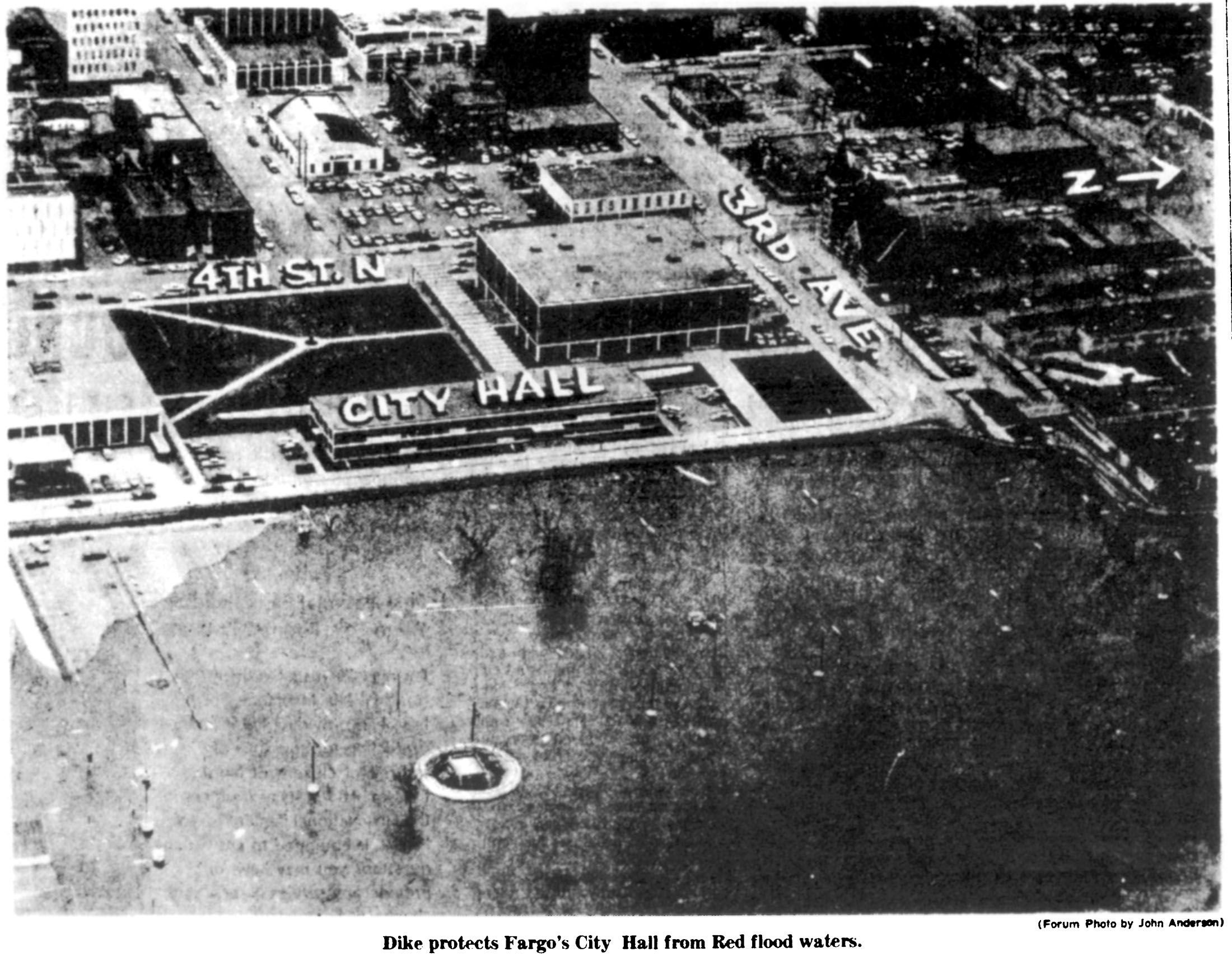
Red River Flood, 1969.
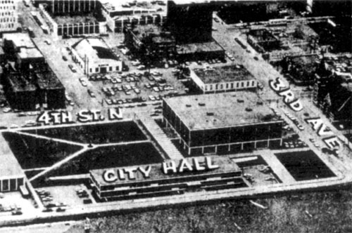
Click for full image In April, 1969, the Red River of the North overflowed its banks, reaching 37.3 feet on the 15th, and expected to crest at 38 feet a few days later. This aerial photo appeared on the front page of the Fargo Forum on the 15th, showing the dike's position in relation to saving city hall, the Civic Center, and the year-old library. Today, the dike runs down 2nd street, atop the river bank, but in 1969, they let the swollen river cover the big parking lot, and ran the dike along 3rd street, just outside City Hall's front doors; the Town House hotel, at the far right in the big picture, looks on the verge of flooding, but safe enough. Labels: 1960s, 1969, city hall, civic center, fargo, flood, library
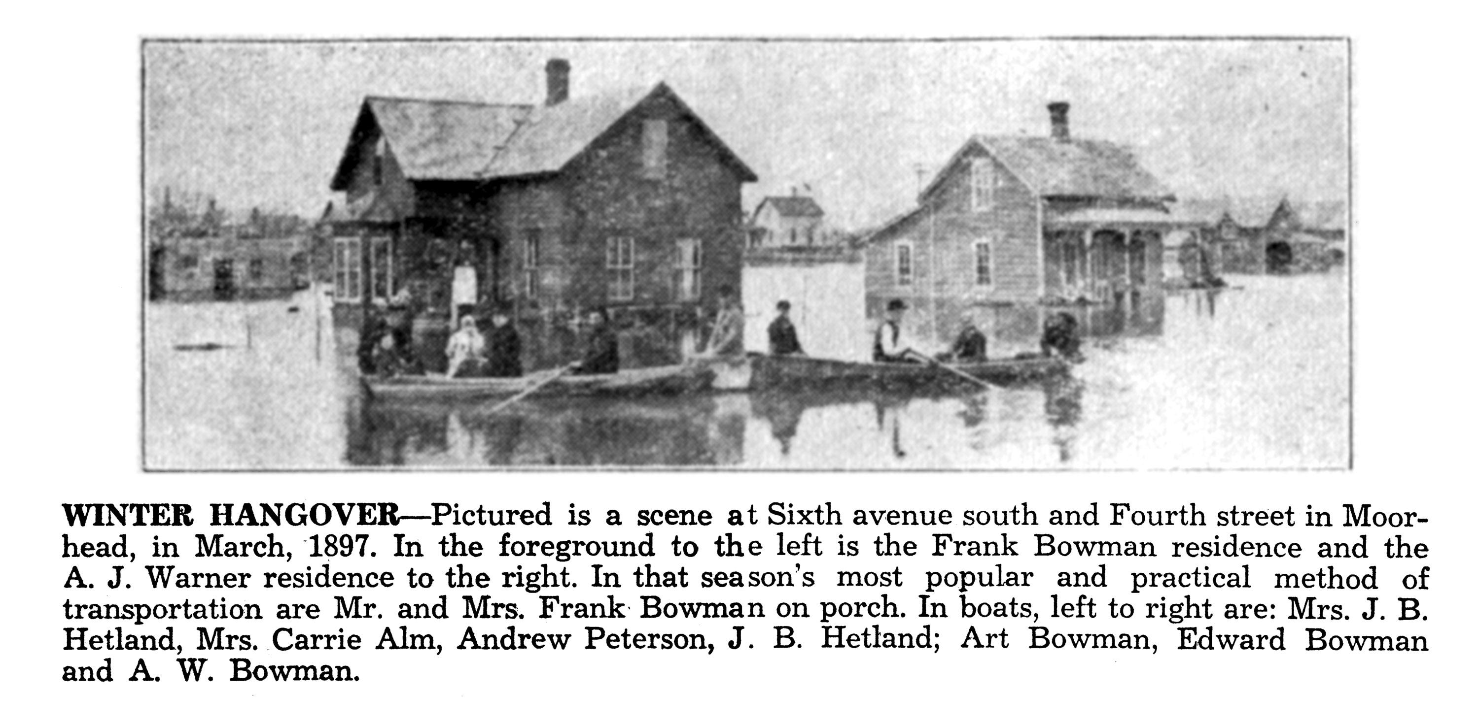
Red River Flood, 1897.
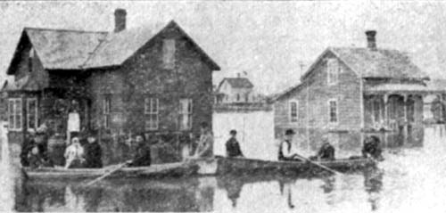
Click for full imageToday, Fargo-Moorhead is readying itself for an unbelievable 40ft+ crest of the Red River on Friday, and are preparing, around the clock, by filling sandbags and building dikes. Twelve years ago we had another huge flood which filled some neighborhoods with water, a hundred year flood so to speak. In fact, a hundred years before that hundred-year flood was the 1897 flood, seen above: floods of this type weren't completely unusual — urban renewal cleared out the most flood-prone neighborhoods during the 1970s on both sides of the river, which had been routinely inundated whenever the river got high. The area of Moorhead in the photo above, however, is still on high ground and is residential: the building on the left seems to still exist, while the one on the right does not. The USGS believes the 1897 flood hit the 40-foot mark as well. Labels: 1890s, 1897, fargophilia, flood, red river
Pfister Barber Shop Party, 1957.
Father and Daughters, 1890s.
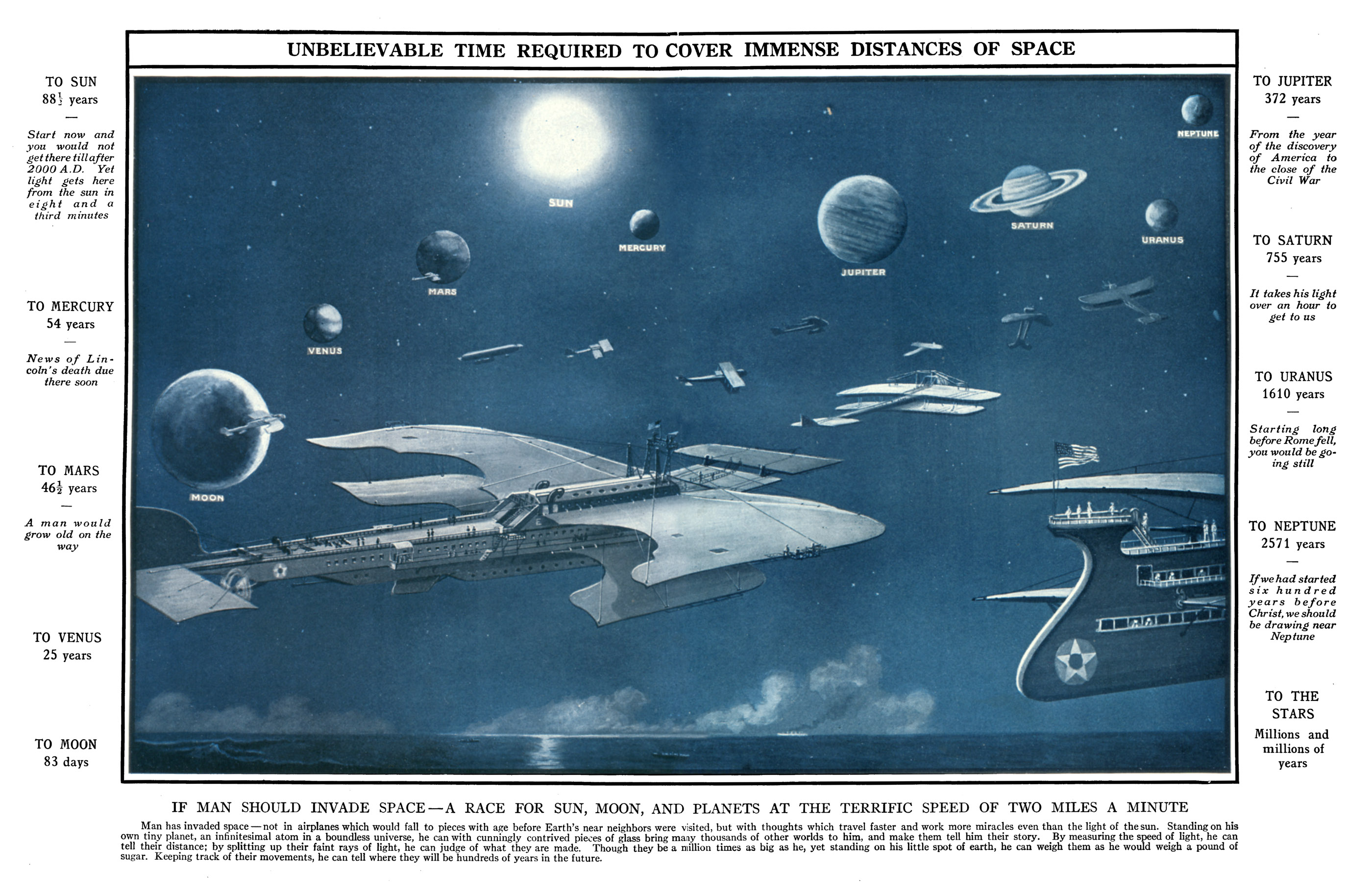
Steam-Powered Space-Ships, 1918.
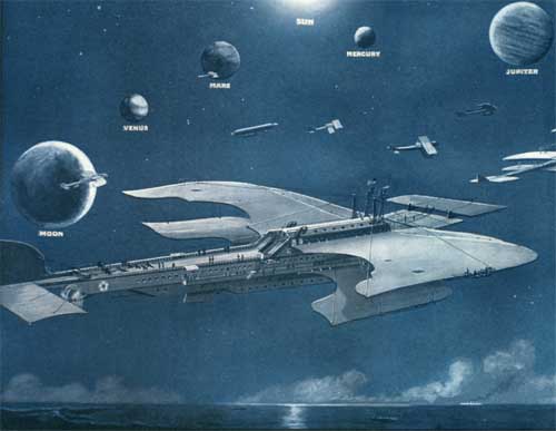
Click for full image If these amazing craft could actually reach the impressive speed of two miles per minute (120mph), how long would it take to reach the sun? Over fifty years, or so says the margin notes in the original. I have never seen such a wonderful portmanteau of craft-shapes compiled into a single speculative spacecraft: the body is like that of a steamship, front-weighted like an airplane, with airelons and control surfaces both fore (like the Wright flyer) and aft (like most airplanes) — and not only did the artist theorize a single spacefaring airship, he or she put together several designs of varying shape, including a space-faring zeppelin in the distance. It also appears that the "wing-like" surfaces were not functional, as you'd expect for a spacecraft: if you look closely, there are observation decks and tiny people at the edges. My use of the word "Steam-powered" is purely an assumption based on the time period; the features that look like smokestacks are supports for the wings; I cannot see any outward evidence of the ship's power source. Based on calculations of time-periods, this was published around 1918 or 1919, so I assume the painting was done shortly before. ( Want wallpaper of this image? here's normal and widescreen.) From Our Wonder World.Labels: 1910s, 1918, airship, space flight, steampunk
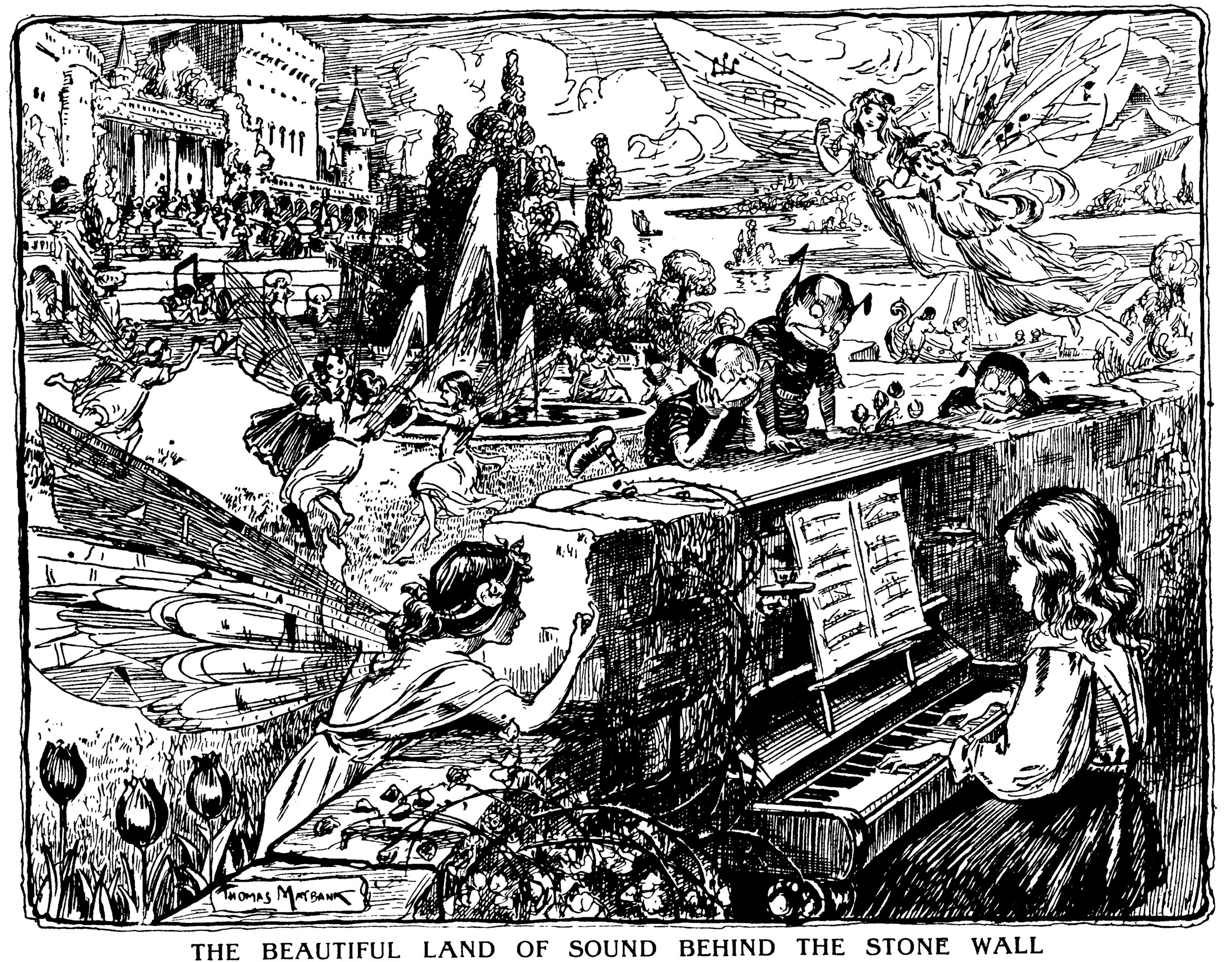
The Beautiful Land of Sound, 1900s.
Dakota City, North Dakota, 1890s.
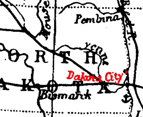
Click for full imageGreetings from scenic Dakota City, North Dakota! It took a little research to figure out what the cartographer was going off of, but the issue may be the result of lazy mapmaking. The full-sized map comes from the Harmsworth Self-Educator, a British encyclopedia from the 1910s. On closer examination, it's odd to see a river called the "Yenne" running curling around the eastern half of the state — that is actually the "She yenne River", which had at some point lost the first part of its name. The mapmaker who produced the map during the 1890s was copying off a map about 40 years older. "Dakota City" was a small settlement, just north of the Sheyenne/Red River confluence about ten miles north of Fargo, north of Harwood's current townsite, established in the 1850s. According to Origins of North Dakota Place Names by Mary Ann Barnes Williams, "In 1895, one log cabin stood at the crossing of the Red River, just opposite LaFayette, Minn., on the Dakota side...known as Dakota City." That one lone log cabin was occupied in the 1860s by "Monsieur Marchaud, a French Canadian, his Chippewa wife and twelve children," according to Seat of the Empire by Charles Coffin. Dakota City, its neighbor Lafayette, and numerous other small townsites never succeeded in reaching actual town status, disappearing well before this map was published. Labels: 1890s, dakota city, maps, north dakota history
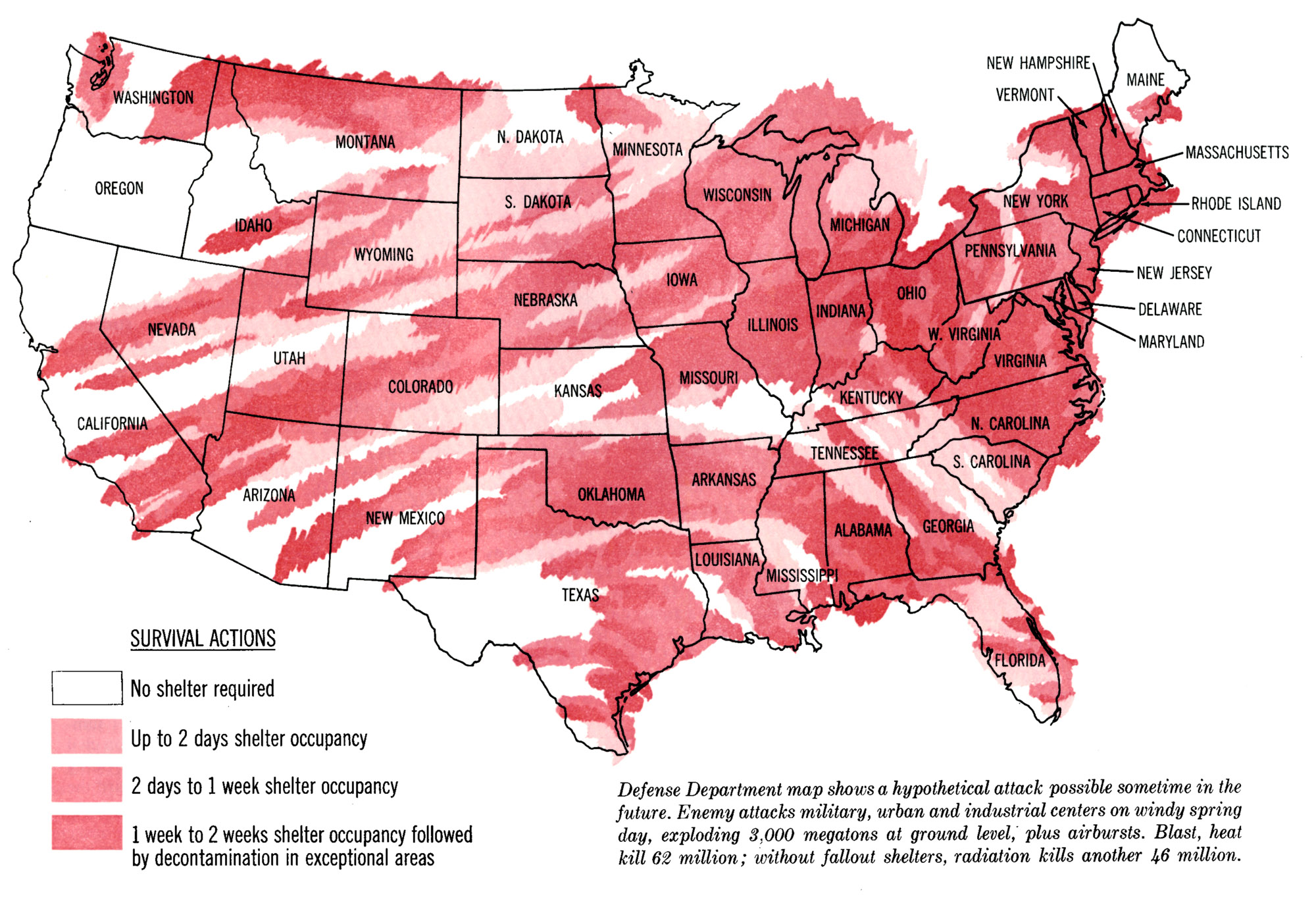
Cold War Wind Patterns, 1963.
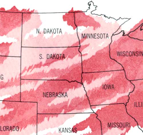
Click for full imageWhat does this map show? It relies on the wind patterns of an average spring day, in that particular decade. That decade was the 1960s, and about the biggest worry to be carried on those spring winds: fallout. This map projects fallout, if an "enemy" were to drop 3,000 megatons on various military, industrial, and civilian targets at the same time, both ground detonations and air bursts. From the Saturday Evening Post, 23 March 1963. Labels: 1960s, 1963, cold war, fallout shelter, maps, saturday evening post
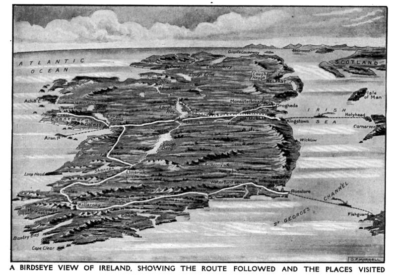
Orthographic Ireland, 1910s.
Jerry "Killer" Meeker, 1945.
Cross-Country Skiing Boys, 1910s.
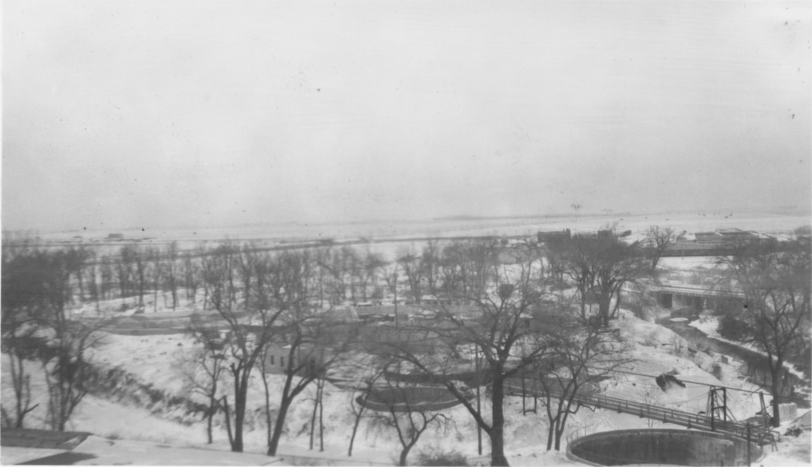
Scenic North Dakota Winter, 1930s.
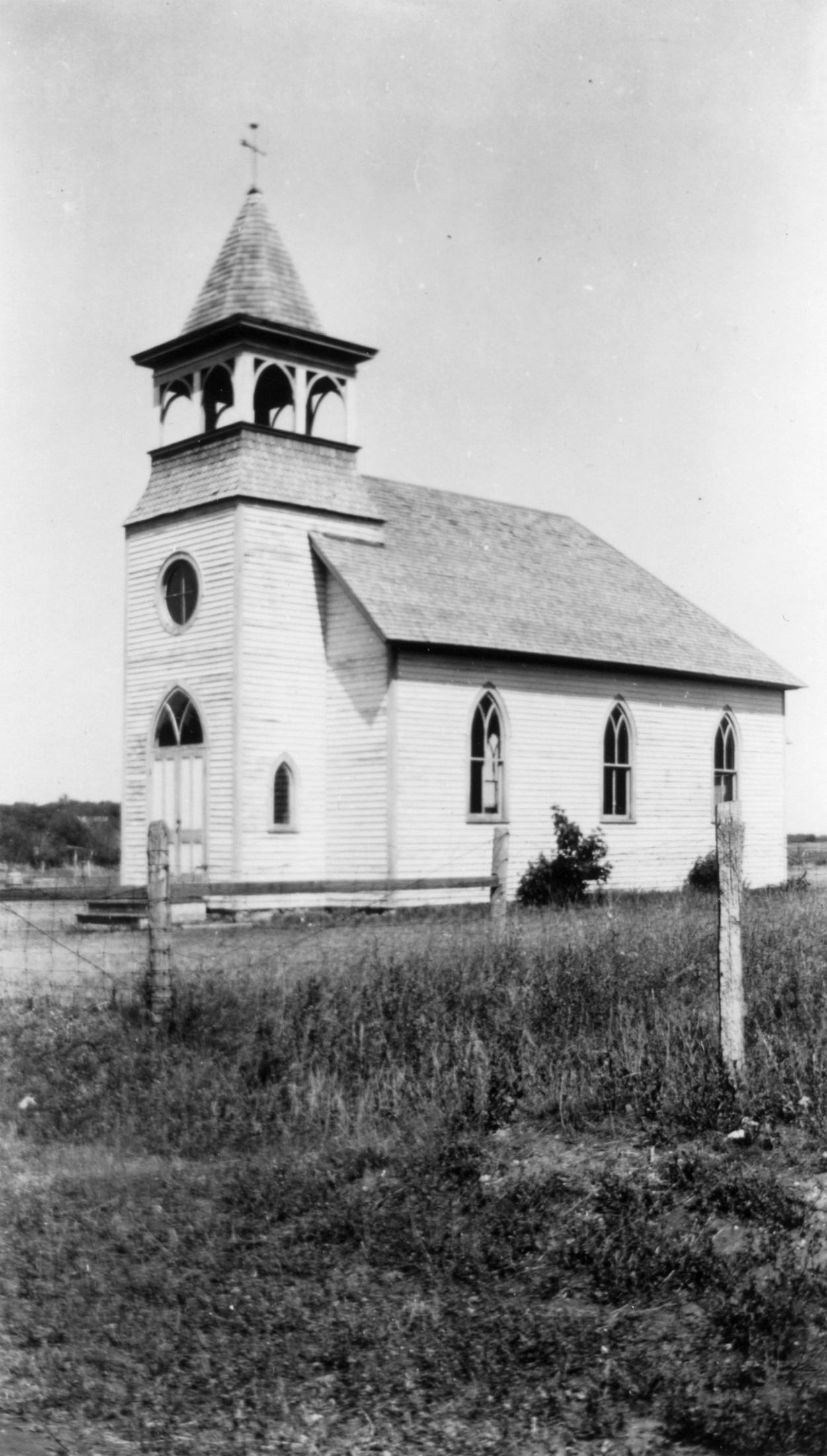
Gothic-Revival Church, 1930s.
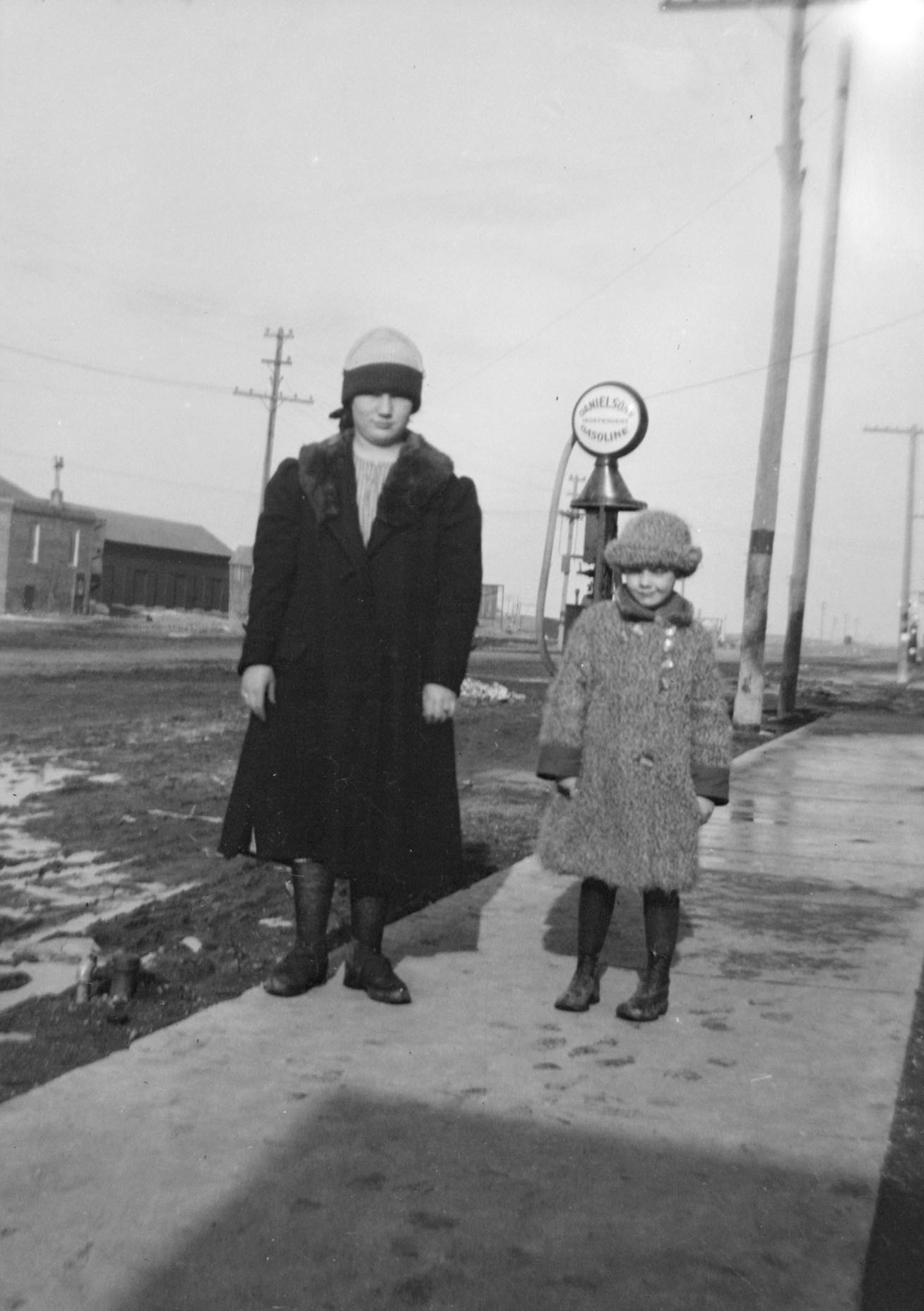
Two Girls, Main Street. 1920s.
 Two young women standing on a sidewalk in a small rural Minnesota town, probably Revere, MN. The gas pump behind them reads, "Daniel's Independent Gasoline." Labels: gas pump, girls, rural, small town, winter
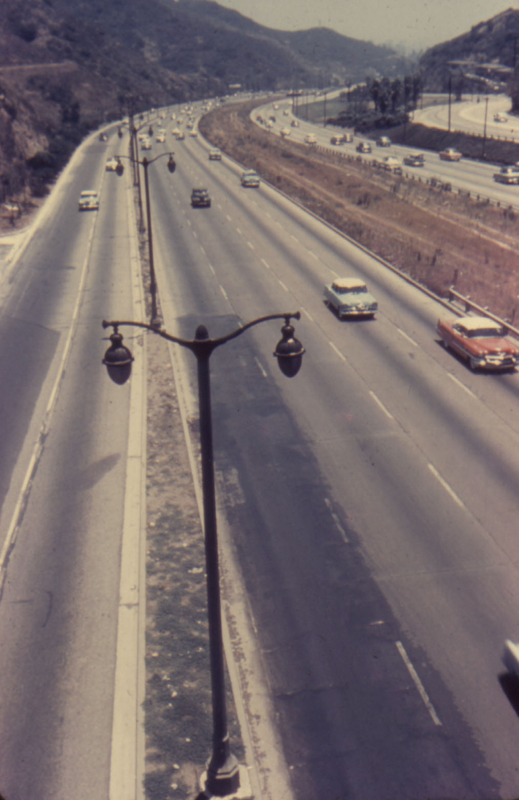
Hollywood Highway, 1950s.
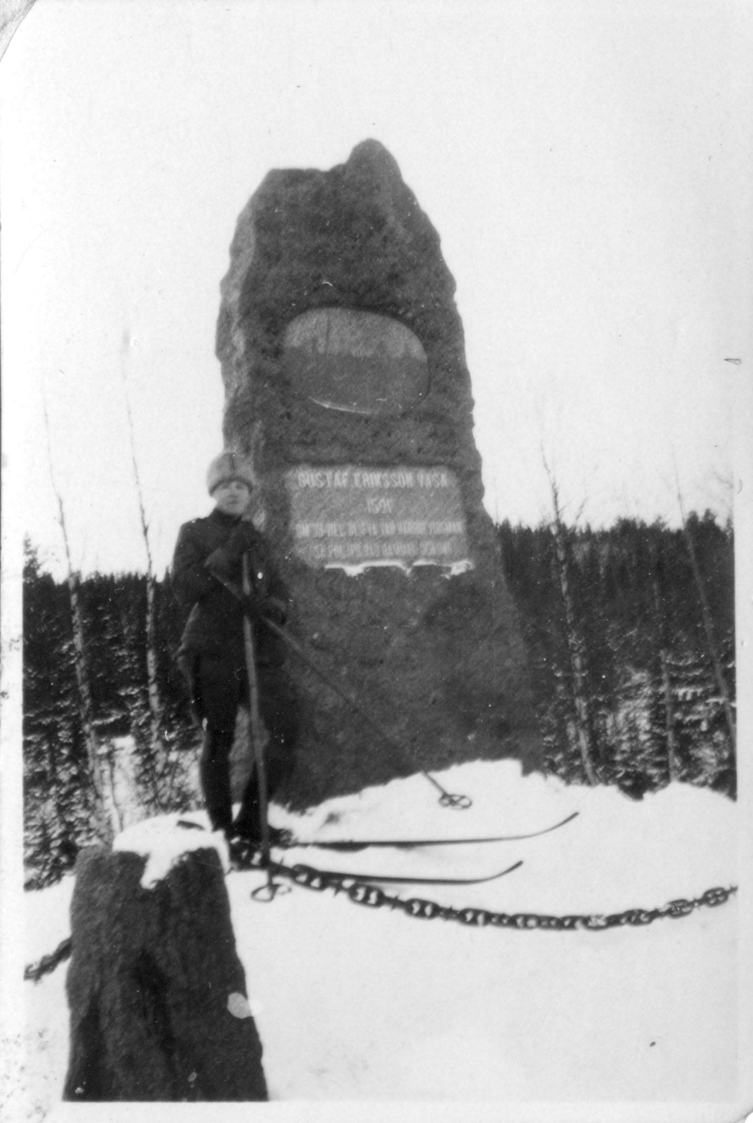
King Gustav Vasastenen, 1910s.
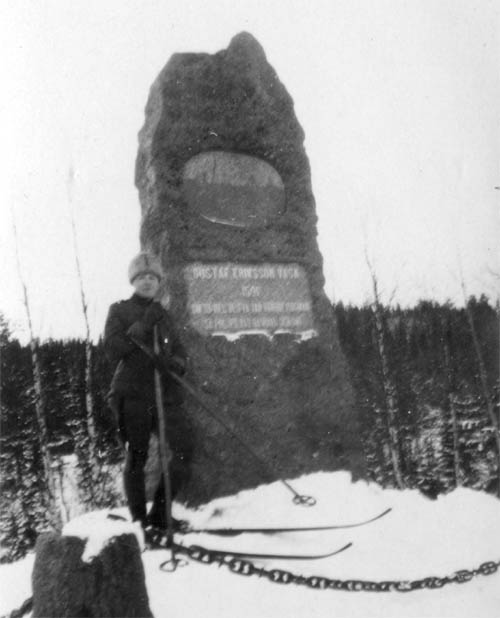
Click for full imageThis monument seen above marks the spot where two village messengers caught up with the fleeing Gustaf Eriksson Vasa, next in line for the throne of Sweden...next in line because the king of Denmark has the rest of Sweden's royalty executed in what is known as the Stolkholm Bloodbath. Gustaf had skiied to Dalarna to try and raise an army, but the locals were hesitant. The Danish army was close behind, so Gustaf left without a positive answer, headed for the safety of Norway. The residents of Dalarna soon changed their minds to conspire with Gustaf, and sent out two swift skiiers to catch the future king of Sweden to let him know they would support his rebellion. That wilderness meeting, marked by the 'Vasastanen' above, is also the premise for the Vasaloppet, a cross-country skiing event held in Dalarna, whose 2009 events begin today. The photo appears to have been taken in the 1910s, possibly earlier. Labels: 1910s, king Gustav I, rebellion, vasaloppet
| |
|
|


